 vesseltracker.com
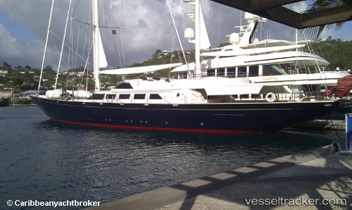
Vessel Sv Antara IMO: 9024906, MMSI: 235011760 Service Ship
UTC, 42.43158, 18.69280, course: 167, speed: 0
UTC, 42.43160, 18.69279, course: 167, speed: 0
2026-01-17 12:43:26 UTC, 42.43161, 18.69281, course: 167, speed: 0
Live AIS position:
UTC. Near TIVAT),
updated 2026-01-17 12:43:26 UTC.
Find the position of the vessel Sv Antara on the map. The latter are known coordinates and path.
marine traffic ship tracker show on live map
The current position of vessel Sv Antara is 42.43161 lat / 18.69281 lng. Updated: 2026-01-17 12:43:26 UTCCurrently sailing under the flag of United Kingdom
Sv Antara built in 1991 year
Deadweight:
61 tDetails:
Last coordinates of the vessel:
UTC, 42.43161, 18.69279, course: 167, speed: 0UTC, 42.43158, 18.69280, course: 167, speed: 0
UTC, 42.43160, 18.69279, course: 167, speed: 0
2026-01-17 12:43:26 UTC, 42.43161, 18.69281, course: 167, speed: 0