 vesseltracker.com
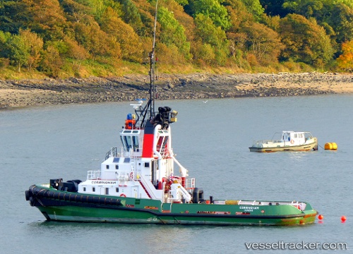
Vessel Corringham IMO: 9316414, MMSI: 235026165 Tug
UTC, 55.99896, -3.37558, course: 180, speed: 0
UTC, 55.99896, -3.37558, course: 180, speed: 0
2026-02-28 22:11:09 UTC, 55.99896, -3.37558, course: 180, speed: 0
Live AIS position:
UTC. Near SOUTH QUEENSFERRY),
updated 2026-02-28 22:11:09 UTC.
Find the position of the vessel Corringham on the map. The latter are known coordinates and path.
marine traffic ship tracker show on live map
The current position of vessel Corringham is 55.99896 lat / -3.37558 lng. Updated: 2026-02-28 22:11:09 UTCCurrently sailing under the flag of United Kingdom
Corringham built in 2005 year
Deadweight:
260 tDetails:
Last coordinates of the vessel:
UTC, 55.99892, -3.37579, course: 228, speed: 0UTC, 55.99896, -3.37558, course: 180, speed: 0
UTC, 55.99896, -3.37558, course: 180, speed: 0
2026-02-28 22:11:09 UTC, 55.99896, -3.37558, course: 180, speed: 0