 vesseltracker.com
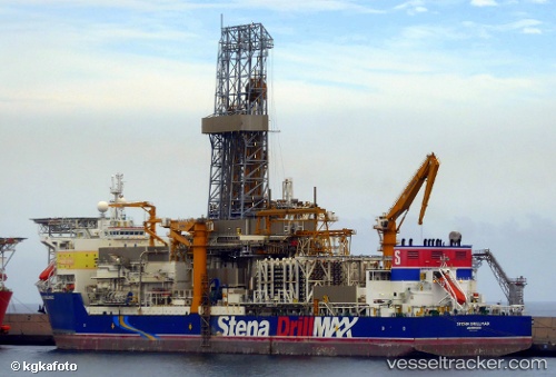
Vessel STENA DRILLMAX IMO: 9364942, MMSI: 235060864 Drilling Ship
UTC, 12.07333, -68.86383, course: 345, speed: 0
UTC, 12.07333, -68.86383, course: 345, speed: 0
2026-02-07 12:01:19 UTC, 12.07333, -68.86333, course: -1, speed: 0
Live AIS position:
UTC. Near Caracas Baai),
updated 2026-02-07 12:01:19 UTC.
Find the position of the vessel STENA DRILLMAX on the map. The latter are known coordinates and path.
marine traffic ship tracker show on live map
The current position of vessel STENA DRILLMAX is 12.07333 lat / -68.86333 lng. Updated: 2026-02-07 12:01:19 UTCCurrently sailing under the flag of United Kingdom
STENA DRILLMAX built in 2007 year
Deadweight:
97000 tDetails:
Last coordinates of the vessel:
UTC, 12.07333, -68.86383, course: 345, speed: 0.1UTC, 12.07333, -68.86383, course: 345, speed: 0
UTC, 12.07333, -68.86383, course: 345, speed: 0
2026-02-07 12:01:19 UTC, 12.07333, -68.86333, course: -1, speed: 0