 vesseltracker.com
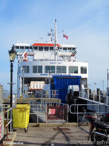
Vessel Wight Sky IMO: 9446984, MMSI: 235064783 Passenger Ro Ro Cargo Ship
UTC, 50.75621, -1.52870, course: 348, speed: 2.6
UTC, 50.70685, -1.50060, course: 12, speed: 0
2026-01-15 09:58:16 UTC, 50.70685, -1.50059, course: 12, speed: 0
Live AIS position:
UTC. Near Yarmouth),
updated 2026-01-15 09:58:16 UTC.
Find the position of the vessel Wight Sky on the map. The latter are known coordinates and path.
marine traffic ship tracker show on live map
The current position of vessel Wight Sky is 50.70685 lat / -1.50059 lng. Updated: 2026-01-15 09:58:16 UTCDetails:
Last coordinates of the vessel:
UTC, 50.70685, -1.50060, course: 12, speed: 0UTC, 50.75621, -1.52870, course: 348, speed: 2.6
UTC, 50.70685, -1.50060, course: 12, speed: 0
2026-01-15 09:58:16 UTC, 50.70685, -1.50059, course: 12, speed: 0