 vesseltracker.com
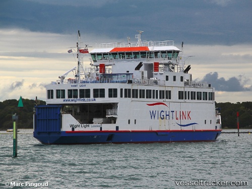
Vessel Wight Light IMO: 9446972, MMSI: 235064784 Passenger Ro Ro Cargo Ship
UTC, 50.75856, -1.53057, course: 334, speed: 0
UTC, 50.75856, -1.53057, course: 334, speed: 0
2026-01-15 18:36:34 UTC, 50.75856, -1.53053, course: 333, speed: 0
Live AIS position:
UTC. Near LYMINGTON),
updated 2026-01-15 18:36:34 UTC.
Find the position of the vessel Wight Light on the map. The latter are known coordinates and path.
marine traffic ship tracker show on live map
The current position of vessel Wight Light is 50.75856 lat / -1.53053 lng. Updated: 2026-01-15 18:36:34 UTCCurrently sailing under the flag of United Kingdom
Wight Light built in 2008 year
Deadweight:
348 tDetails:
Last coordinates of the vessel:
UTC, 50.75857, -1.53056, course: 334, speed: 0UTC, 50.75856, -1.53057, course: 334, speed: 0
UTC, 50.75856, -1.53057, course: 334, speed: 0
2026-01-15 18:36:34 UTC, 50.75856, -1.53053, course: 333, speed: 0