 vesseltracker.com
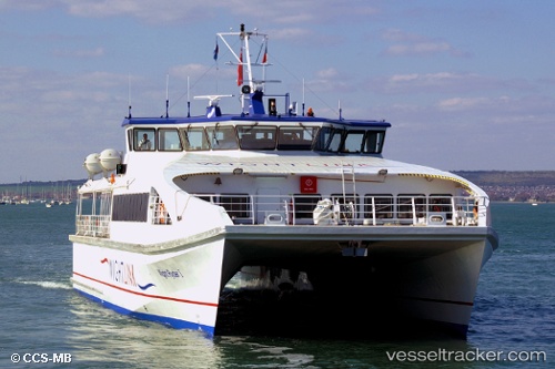
Vessel Wight Ryder 1 IMO: 9512537, MMSI: 235069875 Passenger Ship
UTC, 50.79335, -1.11023, course: -1, speed: 5.5
UTC, 50.79597, -1.10914, course: -1, speed: 0
2026-03-01 01:43:04 UTC, 50.79590, -1.10909, course: -1, speed: 0
Live AIS position:
UTC. Near GOSPORT),
updated 2026-03-01 01:43:04 UTC.
Find the position of the vessel Wight Ryder 1 on the map. The latter are known coordinates and path.
marine traffic ship tracker show on live map
The current position of vessel Wight Ryder 1 is 50.79590 lat / -1.10909 lng. Updated: 2026-03-01 01:43:04 UTCCurrently sailing under the flag of United Kingdom
Wight Ryder 1 built in 2009 year
Deadweight:
130 tDetails:
Last coordinates of the vessel:
UTC, 50.79622, -1.11002, course: -1, speed: 0.4UTC, 50.79335, -1.11023, course: -1, speed: 5.5
UTC, 50.79597, -1.10914, course: -1, speed: 0
2026-03-01 01:43:04 UTC, 50.79590, -1.10909, course: -1, speed: 0