 vesseltracker.com
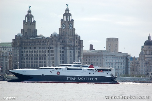
Vessel Manannan IMO: 9176072, MMSI: 235070199 Passenger Ro Ro Cargo Ship
UTC, 54.14775, -4.47101, course: 109, speed: 0
UTC, 54.14775, -4.47100, course: 109, speed: 0
2026-03-03 15:36:18 UTC, 54.14776, -4.47100, course: 108, speed: 0
Live AIS position:
UTC. Near Douglas),
updated 2026-03-03 15:36:18 UTC.
Find the position of the vessel Manannan on the map. The latter are known coordinates and path.
marine traffic ship tracker show on live map
The current position of vessel Manannan is 54.14776 lat / -4.47100 lng. Updated: 2026-03-03 15:36:18 UTCCurrently sailing under the flag of United Kingdom
Manannan built in 1998 year
Deadweight:
800 tDetails:
Last coordinates of the vessel:
UTC, 54.14776, -4.47103, course: 108, speed: 0UTC, 54.14775, -4.47101, course: 109, speed: 0
UTC, 54.14775, -4.47100, course: 109, speed: 0
2026-03-03 15:36:18 UTC, 54.14776, -4.47100, course: 108, speed: 0