 vesseltracker.com
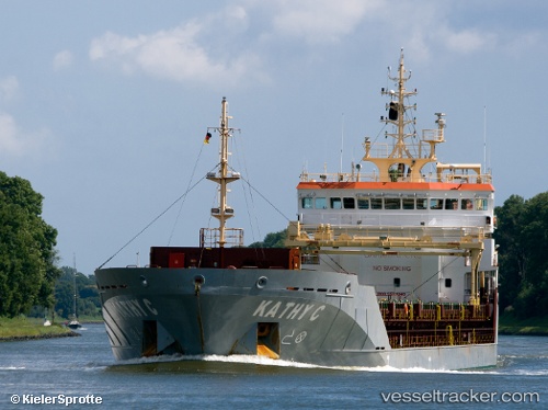
Vessel Kathy C IMO: 9523940, MMSI: 235075591 Multi Purpose Carrier
UTC, 54.52057, 11.39275, course: 113, speed: 10.4
UTC, 54.44522, 11.65390, course: 118, speed: 10
2026-02-22 19:36:16 UTC, 54.45266, 12.23514, course: 38, speed: 10
Live AIS position:
UTC. 10 nm NW of Dierhagen),
updated 2026-02-22 19:36:16 UTC.
Find the position of the vessel Kathy C on the map. The latter are known coordinates and path.
marine traffic ship tracker show on live map
The current position of vessel Kathy C is 54.45266 lat / 12.23514 lng. Updated: 2026-02-22 19:36:16 UTCCurrently sailing under the flag of United Kingdom
Kathy C built in 2010 year
Deadweight:
6750 tDetails:
Last coordinates of the vessel:
UTC, 54.56605, 10.69306, course: 82, speed: 9.9UTC, 54.52057, 11.39275, course: 113, speed: 10.4
UTC, 54.44522, 11.65390, course: 118, speed: 10
2026-02-22 19:36:16 UTC, 54.45266, 12.23514, course: 38, speed: 10