 vesseltracker.com
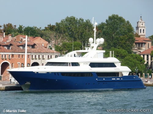
Vessel Mary Jean Ii IMO: 1010595, MMSI: 235080247 Service Ship
UTC, 43.16945, 5.60888, course: 218, speed: 0
UTC, 43.16945, 5.60888, course: 218, speed: 0
2026-03-04 02:18:04 UTC, 43.16945, 5.60888, course: 218, speed: 0
Live AIS position:
UTC. Near LA CIOTAT),
updated 2026-03-04 02:18:04 UTC.
Find the position of the vessel Mary Jean Ii on the map. The latter are known coordinates and path.
marine traffic ship tracker show on live map
The current position of vessel Mary Jean Ii is 43.16945 lat / 5.60888 lng. Updated: 2026-03-04 02:18:04 UTCDetails:
Last coordinates of the vessel:
UTC, 43.16945, 5.60889, course: -1, speed: 0UTC, 43.16945, 5.60888, course: 218, speed: 0
UTC, 43.16945, 5.60888, course: 218, speed: 0
2026-03-04 02:18:04 UTC, 43.16945, 5.60888, course: 218, speed: 0