 vesseltracker.com
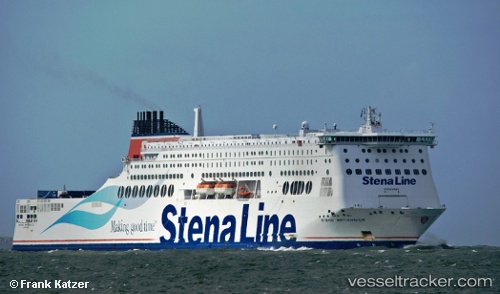
Vessel Stena Britannica IMO: 9419175, MMSI: 235080274 Passenger Ro Ro Cargo Ship
UTC, 51.87987, 2.16966, course: 73, speed: 18.6
UTC, 51.87824, 2.80104, course: 89, speed: 17.1
2026-03-06 13:25:23 UTC, 51.93004, 3.48232, course: -1, speed: 16.8
Live Vessel Stena Britannica Analytics (details, animations, etc.)
Live AIS position: UTC. 12 nm NE of Hunsdon), updated 2026-03-06 13:25:23 UTC.Find the position of the vessel Stena Britannica on the map. The latter are known coordinates and path.
marine traffic ship tracker show on live map
The current position of vessel Stena Britannica is 51.93004 lat / 3.48232 lng. Updated: 2026-03-06 13:25:23 UTCCurrently sailing under the flag of United Kingdom
Stena Britannica built in 2010 year
Deadweight:
11600 tDetails:
Last coordinates of the vessel:
UTC, 51.92500, 1.34667, course: -1, speed: 16UTC, 51.87987, 2.16966, course: 73, speed: 18.6
UTC, 51.87824, 2.80104, course: 89, speed: 17.1
2026-03-06 13:25:23 UTC, 51.93004, 3.48232, course: -1, speed: 16.8