 vesseltracker.com
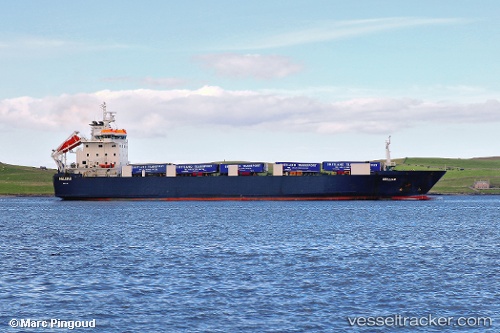
Vessel Helliar IMO: 9119397, MMSI: 235087119 Ro Ro Cargo Ship
UTC, 58.26333, -1.58333, course: -1, speed: 11
UTC, 58.61265, -1.48345, course: 7, speed: 12.2
2026-02-18 01:56:29 UTC, 59.13637, -1.35978, course: 7, speed: 13.2
Live AIS position:
UTC. 24 nm S of Fairisle),
updated 2026-02-18 01:56:29 UTC.
Find the position of the vessel Helliar on the map. The latter are known coordinates and path.
marine traffic ship tracker show on live map
The current position of vessel Helliar is 59.13637 lat / -1.35978 lng. Updated: 2026-02-18 01:56:29 UTCCurrently sailing under the flag of United Kingdom
Helliar built in 1997 year
Deadweight:
5758 tDetails:
Last coordinates of the vessel:
UTC, 58.00153, -1.63664, course: 2, speed: 12.6UTC, 58.26333, -1.58333, course: -1, speed: 11
UTC, 58.61265, -1.48345, course: 7, speed: 12.2
2026-02-18 01:56:29 UTC, 59.13637, -1.35978, course: 7, speed: 13.2