 vesseltracker.com
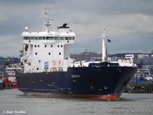
Vessel Hildasay IMO: 9119426, MMSI: 235087121 Ro Ro Cargo Ship
UTC, 58.22167, -1.58833, course: -1, speed: 14
UTC, 58.54625, -1.55813, course: -1, speed: 13.5
2026-03-06 01:12:42 UTC, 58.94667, -1.57500, course: -1, speed: 13
Live Vessel Hildasay Analytics (details, animations, etc.)
Live AIS position: UTC. 26 nm NW of Athena FPSO), updated 2026-03-06 01:12:42 UTC.Find the position of the vessel Hildasay on the map. The latter are known coordinates and path.
marine traffic ship tracker show on live map
The current position of vessel Hildasay is 58.94667 lat / -1.57500 lng. Updated: 2026-03-06 01:12:42 UTCCurrently sailing under the flag of United Kingdom
Hildasay built in 1999 year
Deadweight:
5656 tDetails:
Last coordinates of the vessel:
UTC, 57.81833, -1.63833, course: -1, speed: 14UTC, 58.22167, -1.58833, course: -1, speed: 14
UTC, 58.54625, -1.55813, course: -1, speed: 13.5
2026-03-06 01:12:42 UTC, 58.94667, -1.57500, course: -1, speed: 13