 vesseltracker.com
Find the position of the vessel Seatruck Precision on the map. The latter are known coordinates and path.
marine traffic ship tracker show on live map
The current position of vessel Seatruck Precision is 53.4578 lat / -3.01556 lng. Updated: 2024-10-26 16:21:36 UTCCurrently sailing under the flag of United Kingdom
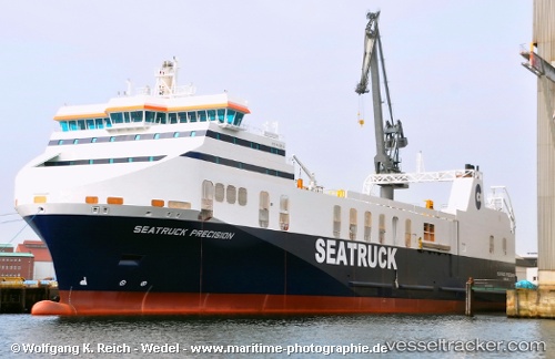
Seatruck Precision built in 2012 year
Port of registry:
Douglas (capital city of the Isle of Man)Deadweight:
5600 tGross tonnage:
18920Service entry:
2012-01-01T00:00:00ZManufacturer:
Flensburger Schiffbau-Gesellschaft (German shipbuilding company)
Owned:
Seatruck Ferries (UK-based freight-only ferry company)Details:
Last coordinates of the vessel:
2024-10-26 16:21:36 UTC, 53.4578, -3.01556, course: 244, speed: 0