 vesseltracker.com
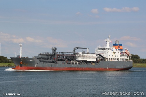
Vessel Dorothea Schulte IMO: 9618862, MMSI: 235093299 Lpg Tanker
UTC, 51.24609, 4.33392, course: 134, speed: 0
UTC, 51.24608, 4.33391, course: 134, speed: 0
2026-01-16 06:32:26 UTC, 51.28072, 4.32183, course: 10, speed: 11.3
Live AIS position:
UTC. Near Lillo),
updated 2026-01-16 06:32:26 UTC.
Find the position of the vessel Dorothea Schulte on the map. The latter are known coordinates and path.
marine traffic ship tracker show on live map
The current position of vessel Dorothea Schulte is 51.28072 lat / 4.32183 lng. Updated: 2026-01-16 06:32:26 UTCCurrently sailing under the flag of United Kingdom
Dorothea Schulte built in 2013 year
Deadweight:
8644 tDetails:
Last coordinates of the vessel:
UTC, 51.24609, 4.33392, course: 134, speed: 0UTC, 51.24609, 4.33392, course: 134, speed: 0
UTC, 51.24608, 4.33391, course: 134, speed: 0
2026-01-16 06:32:26 UTC, 51.28072, 4.32183, course: 10, speed: 11.3