 vesseltracker.com
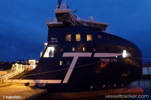
Vessel Troms Lyra IMO: 9649184, MMSI: 235110776 Offshore Tug Supply Ship
UTC, 57.14247, -2.07303, course: 137, speed: 0
UTC, 57.14243, -2.07304, course: 135, speed: 0
2026-01-30 19:42:48 UTC, 57.14012, -2.08054, course: 88, speed: 1.8
Live AIS position:
UTC. Near Aberdeen),
updated 2026-01-30 19:42:48 UTC.
Find the position of the vessel Troms Lyra on the map. The latter are known coordinates and path.
marine traffic ship tracker show on live map
The current position of vessel Troms Lyra is 57.14012 lat / -2.08054 lng. Updated: 2026-01-30 19:42:48 UTCDetails:
Last coordinates of the vessel:
UTC, 57.14244, -2.07299, course: 135, speed: 0UTC, 57.14247, -2.07303, course: 137, speed: 0
UTC, 57.14243, -2.07304, course: 135, speed: 0
2026-01-30 19:42:48 UTC, 57.14012, -2.08054, course: 88, speed: 1.8