 vesseltracker.com
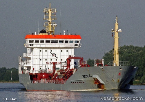
Vessel Paul E IMO: 9268277, MMSI: 236283000 Chemical Oil Products Tanker
UTC, 51.79443, 4.64375, course: 275, speed: 0.1
UTC, 51.79443, 4.64353, course: 276, speed: 0.2
2026-03-14 15:29:24 UTC, 51.79445, 4.64363, course: 276, speed: 0.1
Live Vessel Paul E Analytics (details, animations, etc.)
Live AIS position: UTC. Near S GRAVENDEEL), updated 2026-03-14 15:29:24 UTC.Find the position of the vessel Paul E on the map. The latter are known coordinates and path.
marine traffic ship tracker show on live map
The current position of vessel Paul E is 51.79445 lat / 4.64363 lng. Updated: 2026-03-14 15:29:24 UTCCurrently sailing under the flag of Gibraltar
Paul E built in 2005 year
Deadweight:
6974 tDetails:
Last coordinates of the vessel:
UTC, 51.79438, 4.64373, course: 277, speed: 0.1UTC, 51.79443, 4.64375, course: 275, speed: 0.1
UTC, 51.79443, 4.64353, course: 276, speed: 0.2
2026-03-14 15:29:24 UTC, 51.79445, 4.64363, course: 276, speed: 0.1