 vesseltracker.com
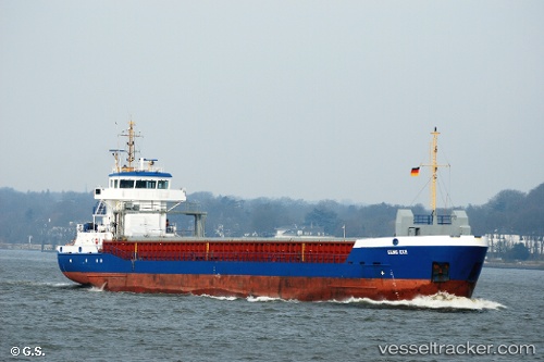
Vessel Eems Exe IMO: 9195535, MMSI: 236452000 Multi Purpose Carrier
UTC, 49.67955, -5.07263, course: 215, speed: 9.5
UTC, 49.31379, -5.51261, course: 218, speed: 8.4
2026-01-14 23:36:22 UTC, 49.27006, -5.56362, course: 218, speed: 8.3
Live AIS position:
UTC. 36 nm N of Ile D’Ouessant),
updated 2026-01-14 23:36:22 UTC.
Find the position of the vessel Eems Exe on the map. The latter are known coordinates and path.
marine traffic ship tracker show on live map
The current position of vessel Eems Exe is 49.27006 lat / -5.56362 lng. Updated: 2026-01-14 23:36:22 UTCCurrently sailing under the flag of Gibraltar
Eems Exe built in 2003 year
Deadweight:
3813 tDetails:
Last coordinates of the vessel:
UTC, 49.78806, -4.94462, course: 216, speed: 9.9UTC, 49.67955, -5.07263, course: 215, speed: 9.5
UTC, 49.31379, -5.51261, course: 218, speed: 8.4
2026-01-14 23:36:22 UTC, 49.27006, -5.56362, course: 218, speed: 8.3