 vesseltracker.com
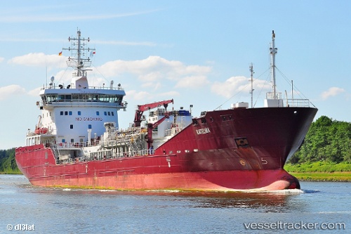
Find the position of the vessel KATELINA on the map. The latter are known coordinates and path.
marine traffic ship tracker show on live map
The current position of vessel KATELINA is 51.7885 lat / 4.63554 lng. Updated: 2024-12-04 17:31:11 UTCCurrently sailing under the flag of Gibraltar
KATELINA built in 2014 year
Port of registry:
Gibraltar (British overseas territory on the coast of Spain)Deadweight:
8933 tPayload_mass:
8933 tonneGross tonnage:
6382Beam:
18 metreService entry:
2014-01-01T00:00:00ZManufacturer:
Zhenjiang Sopo Shipbuilding (former Chinese shipbuilding company (subsidiary of Jiangsu Sopo Group) located in Zhenjiang, Jiangsu province)Details:
Last coordinates of the vessel:
UTC, 51.7886, 4.63559, course: 24, speed: 0UTC, 51.7885, 4.63557, course: 24, speed: 0
UTC, 51.7886, 4.63557, course: 24, speed: 0
2024-12-04 17:31:11 UTC, 51.7885, 4.63554, course: 24, speed: 0