 vesseltracker.com
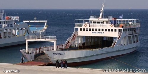
Vessel Nikolaos A IMO: 8652861, MMSI: 237026700 Passenger Landing Craft
UTC, 38.30940, 21.77790, course: -1, speed: 0
UTC, 38.31328, 21.77252, course: -1, speed: 6.1
2026-01-17 10:01:14 UTC, 38.31463, 21.77430, course: -1, speed: 4.7
Live AIS position:
UTC. Near RIO),
updated 2026-01-17 10:01:14 UTC.
Find the position of the vessel Nikolaos A on the map. The latter are known coordinates and path.
marine traffic ship tracker show on live map
The current position of vessel Nikolaos A is 38.31463 lat / 21.77430 lng. Updated: 2026-01-17 10:01:14 UTCDetails:
Last coordinates of the vessel:
UTC, 38.30965, 21.78598, course: -1, speed: 0UTC, 38.30940, 21.77790, course: -1, speed: 0
UTC, 38.31328, 21.77252, course: -1, speed: 6.1
2026-01-17 10:01:14 UTC, 38.31463, 21.77430, course: -1, speed: 4.7