 vesseltracker.com
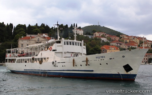
Vessel Postira IMO: 6283202, MMSI: 238114140 Passenger General Cargo Ship
UTC, 44.04167, 15.20500, course: -1, speed: 0
UTC, 44.04202, 15.20585, course: -1, speed: 0
2026-03-03 13:34:17 UTC, 44.04167, 15.20500, course: -1, speed: 0
Live AIS position:
UTC. Near Lamjane),
updated 2026-03-03 13:34:17 UTC.
Find the position of the vessel Postira on the map. The latter are known coordinates and path.
marine traffic ship tracker show on live map
The current position of vessel Postira is 44.04167 lat / 15.20500 lng. Updated: 2026-03-03 13:34:17 UTCDetails:
Last coordinates of the vessel:
UTC, 44.04167, 15.20500, course: -1, speed: 0UTC, 44.04167, 15.20500, course: -1, speed: 0
UTC, 44.04202, 15.20585, course: -1, speed: 0
2026-03-03 13:34:17 UTC, 44.04167, 15.20500, course: -1, speed: 0