 vesseltracker.com
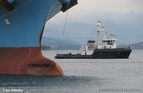
Vessel Beli Kamik IMO: 7722102, MMSI: 238230000 Tug
UTC, 43.44189, 16.64003, course: -1, speed: 0
UTC, 43.44190, 16.64003, course: -1, speed: 0
2026-03-25 03:31:54 UTC, 43.44190, 16.64004, course: -1, speed: 0
Live Vessel Beli Kamik Analytics (details, animations, etc.)
Live AIS position: UTC. Near Dugi Rat), updated 2026-03-25 03:31:54 UTC.Find the position of the vessel Beli Kamik on the map. The latter are known coordinates and path.
marine traffic ship tracker show on live map
The current position of vessel Beli Kamik is 43.44190 lat / 16.64004 lng. Updated: 2026-03-25 03:31:54 UTCCurrently sailing under the flag of Croatia
Beli Kamik built in 1979 year
Deadweight:
131 tDetails:
Last coordinates of the vessel:
UTC, 43.44188, 16.64004, course: -1, speed: 0UTC, 43.44189, 16.64003, course: -1, speed: 0
UTC, 43.44190, 16.64003, course: -1, speed: 0
2026-03-25 03:31:54 UTC, 43.44190, 16.64004, course: -1, speed: 0