 vesseltracker.com
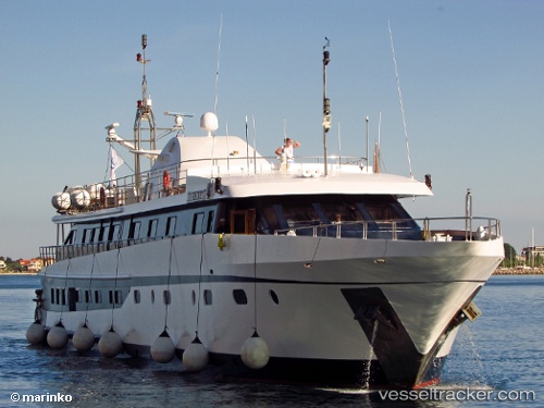
Vessel Harmony G IMO: 8984989, MMSI: 239780000 Service Ship
UTC, 37.96097, 23.57133, course: 3, speed: 0
UTC, 37.96099, 23.57136, course: 3, speed: 0
2026-01-25 13:38:12 UTC, 37.96100, 23.57136, course: 3, speed: 0
Live AIS position:
UTC. Near PERAMA),
updated 2026-01-25 13:38:12 UTC.
Find the position of the vessel Harmony G on the map. The latter are known coordinates and path.
marine traffic ship tracker show on live map
The current position of vessel Harmony G is 37.96100 lat / 23.57136 lng. Updated: 2026-01-25 13:38:12 UTCCurrently sailing under the flag of Greece
Harmony G built in 2001 year
Deadweight:
79 tDetails:
Last coordinates of the vessel:
UTC, 37.96096, 23.57137, course: 3, speed: 0UTC, 37.96097, 23.57133, course: 3, speed: 0
UTC, 37.96099, 23.57136, course: 3, speed: 0
2026-01-25 13:38:12 UTC, 37.96100, 23.57136, course: 3, speed: 0