 vesseltracker.com
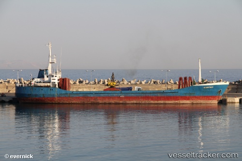
Vessel Artemis S IMO: 7104336, MMSI: 240524000 General Cargo Ship
UTC, 37.96029, 23.56724, course: 4, speed: 0
UTC, 37.96030, 23.56721, course: 2, speed: 0
2026-02-06 21:56:44 UTC, 37.96031, 23.56726, course: 0, speed: 0
Live AIS position:
UTC. Near PERAMA),
updated 2026-02-06 21:56:44 UTC.
Find the position of the vessel Artemis S on the map. The latter are known coordinates and path.
marine traffic ship tracker show on live map
The current position of vessel Artemis S is 37.96031 lat / 23.56726 lng. Updated: 2026-02-06 21:56:44 UTCCurrently sailing under the flag of Greece
Artemis S built in 1971 year
Deadweight:
2039 tDetails:
Last coordinates of the vessel:
UTC, 37.96030, 23.56720, course: 3, speed: 0UTC, 37.96029, 23.56724, course: 4, speed: 0
UTC, 37.96030, 23.56721, course: 2, speed: 0
2026-02-06 21:56:44 UTC, 37.96031, 23.56726, course: 0, speed: 0