 vesseltracker.com
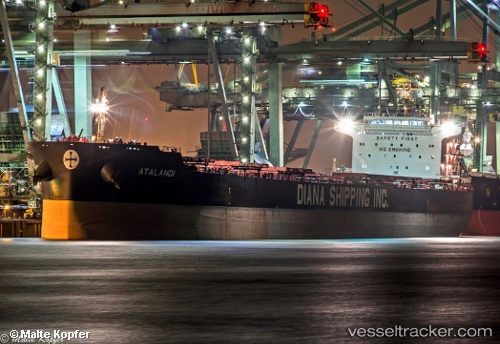
Vessel Atalandi IMO: 9658886, MMSI: 241317000 Bulk Carrier
UTC, 53.65461, 9.51140, course: 163, speed: 0
UTC, 53.65460, 9.51144, course: 163, speed: 0
2026-01-16 23:25:48 UTC, 53.65460, 9.51151, course: 163, speed: 0
Live AIS position:
UTC. Near Stader Sand),
updated 2026-01-16 23:25:48 UTC.
Find the position of the vessel Atalandi on the map. The latter are known coordinates and path.
marine traffic ship tracker show on live map
The current position of vessel Atalandi is 53.65460 lat / 9.51151 lng. Updated: 2026-01-16 23:25:48 UTCDetails:
Last coordinates of the vessel:
UTC, 53.65463, 9.51146, course: 163, speed: 0UTC, 53.65461, 9.51140, course: 163, speed: 0
UTC, 53.65460, 9.51144, course: 163, speed: 0
2026-01-16 23:25:48 UTC, 53.65460, 9.51151, course: 163, speed: 0