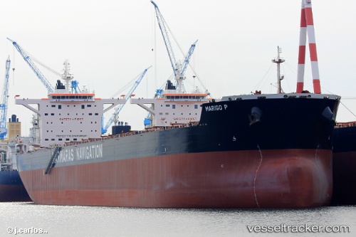
Find the position of the vessel Marigo P on the map. The latter are known coordinates and path.
marine traffic ship tracker show on live map
The current position of vessel Marigo P is 26.3837 lat / 119.764 lng. Updated: 2024-11-15 01:10:07 UTCPayload_mass:
179218 tonneGross tonnage:
93613Service entry:
2016-01-01T00:00:00ZManufacturer:
Sungdong Shipbuilding & Marine Engineering (South Korean shipbuilding company)Details:
Last coordinates of the vessel:
UTC, 26.3838, 119.764, course: 236, speed: 0.1UTC, 26.3837, 119.764, course: 236, speed: 0.1
UTC, 26.3837, 119.764, course: 236, speed: 0.1
2024-11-15 01:10:07 UTC, 26.3837, 119.764, course: 236, speed: 0.1

 vesseltracker.com