 vesseltracker.com
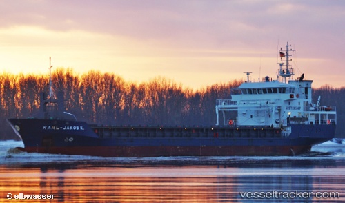
Find the position of the vessel Karl Jakob K on the map. The latter are known coordinates and path.
marine traffic ship tracker show on live map
The current position of vessel Karl Jakob K is 47.115 lat / -6.86524 lng. Updated: 2024-05-04 04:17:44 UTCCurrently sailing under the flag of Netherlands
Karl Jakob K built in 2006 year
Port of registry:
Delfzijl (city and former municipality in Groningen, Netherlands)Deadweight:
4264 tPayload_mass:
4264 tonneGross tonnage:
3057Beam:
15.2 metreService entry:
2006-01-01T00:00:00ZManufacturer:
Ruse ShipyardDetails:
Last coordinates of the vessel:
UTC, 46.5467, -7.295, course: -1, speed: 10UTC, 46.8317, -7.07667, course: -1, speed: 10
UTC, 46.9717, -6.97667, course: -1, speed: 10
2024-05-04 04:17:44 UTC, 47.115, -6.86524, course: 28, speed: 9.2