 vesseltracker.com
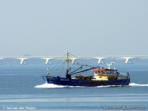
Vessel Bru 8 Marinus IMO: 8911970, MMSI: 244035000 Fishing Vessel
UTC, 51.65281, 4.09965, course: 119, speed: 0
UTC, 51.65281, 4.09964, course: 121, speed: 0
2026-03-02 13:23:56 UTC, 51.65281, 4.09965, course: 118, speed: 0
Live AIS position:
UTC. Near BRUINISSE),
updated 2026-03-02 13:23:56 UTC.
Find the position of the vessel Bru 8 Marinus on the map. The latter are known coordinates and path.
marine traffic ship tracker show on live map
The current position of vessel Bru 8 Marinus is 51.65281 lat / 4.09965 lng. Updated: 2026-03-02 13:23:56 UTCCurrently sailing under the flag of Netherlands
Bru 8 Marinus built in 1990 year
Details:
Last coordinates of the vessel:
UTC, 51.65281, 4.09964, course: 117, speed: 0UTC, 51.65281, 4.09965, course: 119, speed: 0
UTC, 51.65281, 4.09964, course: 121, speed: 0
2026-03-02 13:23:56 UTC, 51.65281, 4.09965, course: 118, speed: 0