 vesseltracker.com
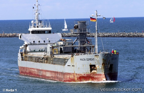
Vessel Malta Cement IMO: 8911841, MMSI: 244090800 Cement Carrier
UTC, 45.07403, -5.70378, course: 14, speed: 9.8
UTC, 45.07403, -5.70378, course: 14, speed: 9.8
2026-02-04 22:02:46 UTC, 45.07403, -5.70378, course: 14, speed: 9.8
Live AIS position:
UTC. 39 nm W of Saint-Romain-de-Lerps),
updated 2026-02-04 22:02:46 UTC.
Find the position of the vessel Malta Cement on the map. The latter are known coordinates and path.
marine traffic ship tracker show on live map
The current position of vessel Malta Cement is 45.07403 lat / -5.70378 lng. Updated: 2026-02-04 22:02:46 UTCCurrently sailing under the flag of Netherlands
Malta Cement built in 1991 year
Deadweight:
3961 tDetails:
Last coordinates of the vessel:
UTC, 44.80430, -5.81162, course: 0, speed: 7.3UTC, 45.07403, -5.70378, course: 14, speed: 9.8
UTC, 45.07403, -5.70378, course: 14, speed: 9.8
2026-02-04 22:02:46 UTC, 45.07403, -5.70378, course: 14, speed: 9.8