 vesseltracker.com
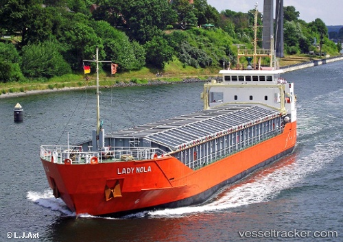
Vessel Lady Nola IMO: 9243863, MMSI: 244150000 General Cargo Ship
UTC, 52.84167, 5.71333, course: -1, speed: 0
UTC, 52.84167, 5.71333, course: -1, speed: 0
2026-03-02 03:48:54 UTC, 52.84167, 5.71333, course: -1, speed: 0
Live AIS position:
UTC. Near LEMMER),
updated 2026-03-02 03:48:54 UTC.
Find the position of the vessel Lady Nola on the map. The latter are known coordinates and path.
marine traffic ship tracker show on live map
The current position of vessel Lady Nola is 52.84167 lat / 5.71333 lng. Updated: 2026-03-02 03:48:54 UTCCurrently sailing under the flag of Netherlands
Lady Nola built in 2002 year
Deadweight:
3002 tDetails:
Last coordinates of the vessel:
UTC, 52.84167, 5.71333, course: -1, speed: 0UTC, 52.84167, 5.71333, course: -1, speed: 0
UTC, 52.84167, 5.71333, course: -1, speed: 0
2026-03-02 03:48:54 UTC, 52.84167, 5.71333, course: -1, speed: 0