 vesseltracker.com
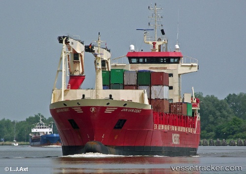
Vessel Jan Van Gent IMO: 9456721, MMSI: 244170000 Multi Purpose Carrier
UTC, 51.89128, 4.29515, course: 71, speed: 0
UTC, 51.89128, 4.29511, course: 71, speed: 0
2026-01-15 02:53:11 UTC, 51.89126, 4.29507, course: 71, speed: 0
Live AIS position:
UTC. Near BOTLEK - ROTTERDAM),
updated 2026-01-15 02:53:11 UTC.
Find the position of the vessel Jan Van Gent on the map. The latter are known coordinates and path.
marine traffic ship tracker show on live map
The current position of vessel Jan Van Gent is 51.89126 lat / 4.29507 lng. Updated: 2026-01-15 02:53:11 UTCCurrently sailing under the flag of Netherlands
Jan Van Gent built in 2009 year
Deadweight:
12080 tDetails:
Last coordinates of the vessel:
UTC, 51.89128, 4.29509, course: 71, speed: 0UTC, 51.89128, 4.29515, course: 71, speed: 0
UTC, 51.89128, 4.29511, course: 71, speed: 0
2026-01-15 02:53:11 UTC, 51.89126, 4.29507, course: 71, speed: 0