 vesseltracker.com
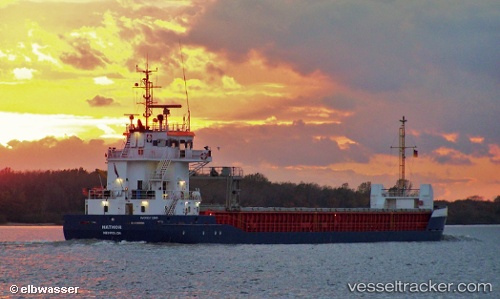
Vessel Hathor IMO: 9373280, MMSI: 244176000 General Cargo Ship
UTC, 46.08922, -1.25779, course: 231, speed: 0.3
UTC, 45.95909, -0.99446, course: 191, speed: 10.6
2026-03-01 14:09:36 UTC, 45.93894, -0.90698, course: 225, speed: 0
Live AIS position:
UTC. Near Tonnay-Charente),
updated 2026-03-01 14:09:36 UTC.
Find the position of the vessel Hathor on the map. The latter are known coordinates and path.
marine traffic ship tracker show on live map
The current position of vessel Hathor is 45.93894 lat / -0.90698 lng. Updated: 2026-03-01 14:09:36 UTCCurrently sailing under the flag of Netherlands
Hathor built in 2007 year
Deadweight:
3850 tDetails:
Last coordinates of the vessel:
UTC, 46.08930, -1.25773, course: 229, speed: 0.2UTC, 46.08922, -1.25779, course: 231, speed: 0.3
UTC, 45.95909, -0.99446, course: 191, speed: 10.6
2026-03-01 14:09:36 UTC, 45.93894, -0.90698, course: 225, speed: 0