 vesseltracker.com
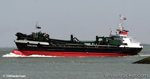
Find the position of the vessel Swalinge on the map. The latter are known coordinates and path.
marine traffic ship tracker show on live map
The current position of vessel Swalinge is 53.4188 lat / 0.518152 lng. Updated: 2024-05-06 01:36:59 UTCCurrently sailing under the flag of Netherlands
Swalinge built in 1977 year
Deadweight:
3064 tService entry:
1977-01-01T00:00:00ZManufacturer:
Barkmeijer Shipyards (former shipyard in Gerkesklooster, Netherlands)
Details:
Last coordinates of the vessel:
UTC, 53.8636, 0.243732, course: 147, speed: 13.1UTC, 53.7025, 0.396803, course: 139, speed: 13.5
UTC, 53.4285, 0.518625, course: 182, speed: 12.3
2024-05-06 01:36:59 UTC, 53.4188, 0.518152, course: 182, speed: 12.3