 vesseltracker.com
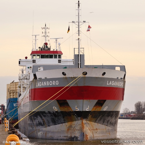
Vessel Laganborg IMO: 9407419, MMSI: 244297000 Multi Purpose Carrier
UTC, 43.33667, -3.03833, course: -1, speed: 0
UTC, 43.33672, -3.03879, course: -1, speed: 0
2026-03-03 18:12:21 UTC, 43.33671, -3.03882, course: -1, speed: 0
Live AIS position:
UTC. Near Santurce),
updated 2026-03-03 18:12:21 UTC.
Find the position of the vessel Laganborg on the map. The latter are known coordinates and path.
marine traffic ship tracker show on live map
The current position of vessel Laganborg is 43.33671 lat / -3.03882 lng. Updated: 2026-03-03 18:12:21 UTCCurrently sailing under the flag of Netherlands
Laganborg built in 2008 year
Deadweight:
7350 tDetails:
Last coordinates of the vessel:
UTC, 43.33667, -3.03833, course: -1, speed: 0UTC, 43.33667, -3.03833, course: -1, speed: 0
UTC, 43.33672, -3.03879, course: -1, speed: 0
2026-03-03 18:12:21 UTC, 43.33671, -3.03882, course: -1, speed: 0