 vesseltracker.com
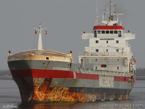
Vessel Virginiaborg IMO: 9234290, MMSI: 244632000 General Cargo Ship
UTC, 53.44723, -3.01064, course: 70, speed: 0
UTC, 53.44723, -3.01063, course: 68, speed: 0
2026-02-18 17:23:29 UTC, 53.44724, -3.01064, course: 69, speed: 0
Live AIS position:
UTC. Near Liverpool),
updated 2026-02-18 17:23:29 UTC.
Find the position of the vessel Virginiaborg on the map. The latter are known coordinates and path.
marine traffic ship tracker show on live map
The current position of vessel Virginiaborg is 53.44724 lat / -3.01064 lng. Updated: 2026-02-18 17:23:29 UTCCurrently sailing under the flag of Netherlands
Virginiaborg built in 2001 year
Deadweight:
9600 tDetails:
Last coordinates of the vessel:
UTC, 53.44725, -3.01065, course: 69, speed: 0UTC, 53.44723, -3.01064, course: 70, speed: 0
UTC, 53.44723, -3.01063, course: 68, speed: 0
2026-02-18 17:23:29 UTC, 53.44724, -3.01064, course: 69, speed: 0