 vesseltracker.com
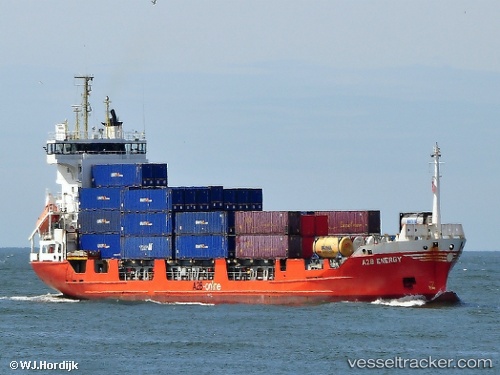
Vessel A2b Energy IMO: 9183427, MMSI: 244650437 Container Ship
UTC, 51.25458, 4.35520, course: 236, speed: 0
UTC, 51.25456, 4.35520, course: 236, speed: 0
2026-03-02 12:07:43 UTC, 51.25455, 4.35518, course: 236, speed: 0
Live AIS position:
UTC. Near Pijp Tabak),
updated 2026-03-02 12:07:43 UTC.
Find the position of the vessel A2b Energy on the map. The latter are known coordinates and path.
marine traffic ship tracker show on live map
The current position of vessel A2b Energy is 51.25455 lat / 4.35518 lng. Updated: 2026-03-02 12:07:43 UTCCurrently sailing under the flag of Netherlands
A2b Energy built in 1998 year
Deadweight:
5356 tDetails:
Last coordinates of the vessel:
UTC, 51.25461, 4.35522, course: 236, speed: 0UTC, 51.25458, 4.35520, course: 236, speed: 0
UTC, 51.25456, 4.35520, course: 236, speed: 0
2026-03-02 12:07:43 UTC, 51.25455, 4.35518, course: 236, speed: 0