 vesseltracker.com
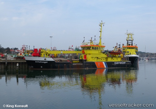
Vessel Schuitengat IMO: 8900804, MMSI: 244652000 Buoy Lighthouse Vessel
UTC, 51.89057, 4.39880, course: 255, speed: 0
2026-01-30 12:07:34 UTC, 51.89057, 4.39880, course: 255, speed: 0
Live AIS position:
UTC. Near ROTTERDAM PERNIS),
updated 2026-01-30 12:07:34 UTC.
Find the position of the vessel Schuitengat on the map. The latter are known coordinates and path.
marine traffic ship tracker show on live map
The current position of vessel Schuitengat is 51.89057 lat / 4.39880 lng. Updated: 2026-01-30 12:07:34 UTCCurrently sailing under the flag of Netherlands
Schuitengat built in 1990 year
Details:
Last coordinates of the vessel:
UTC, 51.89057, 4.39880, course: 255, speed: 0UTC, 51.89057, 4.39880, course: 255, speed: 0
2026-01-30 12:07:34 UTC, 51.89057, 4.39880, course: 255, speed: 0