 vesseltracker.com
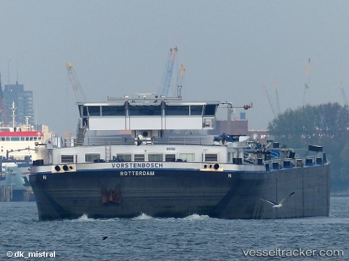
Vessel Vorstenbosch IMO: 9484132, MMSI: 244660862 Chemical Oil Products Tanker
UTC, 51.89213, 4.36728, course: -1, speed: 0
UTC, 51.88912, 4.36313, course: -1, speed: 1.5
2026-03-17 02:08:43 UTC, 51.88784, 4.35603, course: -1, speed: 0
Live Vessel Vorstenbosch Analytics (details, animations, etc.)
Live AIS position: UTC. Near VONDELINGENPLAAT - ROTTERDAM), updated 2026-03-17 02:08:43 UTC.Find the position of the vessel Vorstenbosch on the map. The latter are known coordinates and path.
marine traffic ship tracker show on live map
The current position of vessel Vorstenbosch is 51.88784 lat / 4.35603 lng. Updated: 2026-03-17 02:08:43 UTCCurrently sailing under the flag of Netherlands
Details:
Last coordinates of the vessel:
UTC, 51.83591, 4.48686, course: -1, speed: 11.1UTC, 51.89213, 4.36728, course: -1, speed: 0
UTC, 51.88912, 4.36313, course: -1, speed: 1.5
2026-03-17 02:08:43 UTC, 51.88784, 4.35603, course: -1, speed: 0