 vesseltracker.com
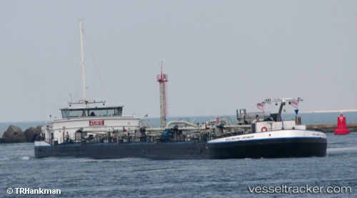
Vessel Atlantic Power IMO: 9368534, MMSI: 244670062 Other Tanker
UTC, 51.27923, 4.36137, course: -1, speed: 0
UTC, 51.27925, 4.36137, course: -1, speed: 0
2026-01-15 02:55:09 UTC, 51.27921, 4.36136, course: -1, speed: 0
Live AIS position:
UTC. Near Hoevenen),
updated 2026-01-15 02:55:09 UTC.
Find the position of the vessel Atlantic Power on the map. The latter are known coordinates and path.
marine traffic ship tracker show on live map
The current position of vessel Atlantic Power is 51.27921 lat / 4.36136 lng. Updated: 2026-01-15 02:55:09 UTCCurrently sailing under the flag of Netherlands
Atlantic Power built in 2006 year
Deadweight:
4525 tDetails:
Last coordinates of the vessel:
UTC, 51.27923, 4.36134, course: -1, speed: 0UTC, 51.27923, 4.36137, course: -1, speed: 0
UTC, 51.27925, 4.36137, course: -1, speed: 0
2026-01-15 02:55:09 UTC, 51.27921, 4.36136, course: -1, speed: 0