 vesseltracker.com
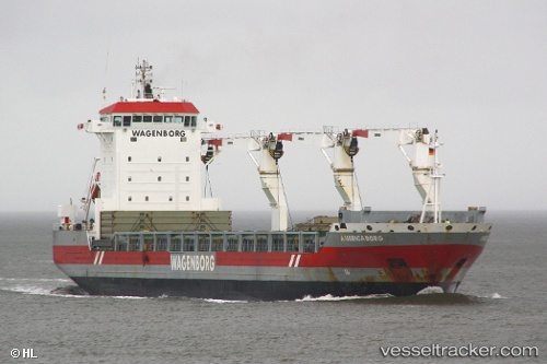
Vessel Americaborg IMO: 9365659, MMSI: 244693000 Multi Purpose Carrier
UTC, 39.26284, -76.59500, course: 114, speed: 0
UTC, 39.26283, -76.59500, course: 113, speed: 0
2026-01-14 08:19:37 UTC, 39.26283, -76.59502, course: 114, speed: 0
Live AIS position:
UTC. Near South Baltimore),
updated 2026-01-14 08:19:37 UTC.
Find the position of the vessel Americaborg on the map. The latter are known coordinates and path.
marine traffic ship tracker show on live map
The current position of vessel Americaborg is 39.26283 lat / -76.59502 lng. Updated: 2026-01-14 08:19:37 UTCCurrently sailing under the flag of Netherlands
Americaborg built in 2007 year
Deadweight:
17356 tDetails:
Last coordinates of the vessel:
UTC, 39.26283, -76.59501, course: 114, speed: 0.1UTC, 39.26284, -76.59500, course: 114, speed: 0
UTC, 39.26283, -76.59500, course: 113, speed: 0
2026-01-14 08:19:37 UTC, 39.26283, -76.59502, course: 114, speed: 0