 vesseltracker.com
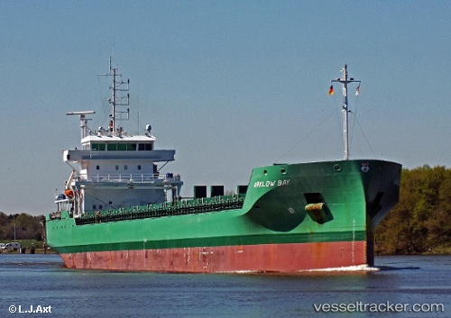
Vessel Arklow Bay IMO: 9638771, MMSI: 244700336 General Cargo Ship
UTC, 59.12228, 9.61548, course: 29, speed: 0
UTC, 59.12228, 9.61548, course: 28, speed: 0
2026-01-18 22:25:57 UTC, 59.12227, 9.61547, course: 28, speed: 0
Live AIS position:
UTC. Near PORSGRUNN),
updated 2026-01-18 22:25:57 UTC.
Find the position of the vessel Arklow Bay on the map. The latter are known coordinates and path.
marine traffic ship tracker show on live map
The current position of vessel Arklow Bay is 59.12227 lat / 9.61547 lng. Updated: 2026-01-18 22:25:57 UTCCurrently sailing under the flag of Netherlands
Arklow Bay built in 2014 year
Deadweight:
8400 tDetails:
Last coordinates of the vessel:
UTC, 59.12228, 9.61547, course: 28, speed: 0UTC, 59.12228, 9.61548, course: 29, speed: 0
UTC, 59.12228, 9.61548, course: 28, speed: 0
2026-01-18 22:25:57 UTC, 59.12227, 9.61547, course: 28, speed: 0