 vesseltracker.com
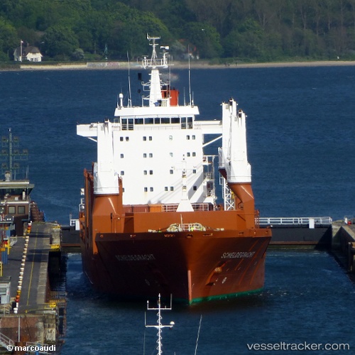
Vessel Scheldegracht IMO: 9202510, MMSI: 244730000 General Cargo Ship
UTC, 29.23349, -94.64372, course: 192, speed: 0.4
UTC, 29.23347, -94.64366, course: 196, speed: 0.3
2026-01-16 21:30:01 UTC, 29.23356, -94.64398, course: 204, speed: 0.2
Live AIS position:
UTC. Near Galveston),
updated 2026-01-16 21:30:01 UTC.
Find the position of the vessel Scheldegracht on the map. The latter are known coordinates and path.
marine traffic ship tracker show on live map
The current position of vessel Scheldegracht is 29.23356 lat / -94.64398 lng. Updated: 2026-01-16 21:30:01 UTCCurrently sailing under the flag of Netherlands
Scheldegracht built in 2000 year
Deadweight:
21250 tDetails:
Last coordinates of the vessel:
UTC, 29.23370, -94.64399, course: 188, speed: 0.2UTC, 29.23349, -94.64372, course: 192, speed: 0.4
UTC, 29.23347, -94.64366, course: 196, speed: 0.3
2026-01-16 21:30:01 UTC, 29.23356, -94.64398, course: 204, speed: 0.2