 vesseltracker.com
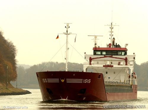
Vessel Isis IMO: 9357494, MMSI: 244768000 Multi Purpose Carrier
UTC, 63.86254, 23.03447, course: -1, speed: 0
UTC, 63.86254, 23.03446, course: -1, speed: 0
2026-03-06 15:36:14 UTC, 63.86254, 23.03447, course: -1, speed: 0
Live Vessel Isis Analytics (details, animations, etc.)
Live AIS position: UTC. Near Yxpila), updated 2026-03-06 15:36:14 UTC.Find the position of the vessel Isis on the map. The latter are known coordinates and path.
marine traffic ship tracker show on live map
The current position of vessel Isis is 63.86254 lat / 23.03447 lng. Updated: 2026-03-06 15:36:14 UTCCurrently sailing under the flag of Netherlands
Isis built in 2007 year
Deadweight:
6000 tDetails:
Last coordinates of the vessel:
UTC, 63.86254, 23.03444, course: -1, speed: 0UTC, 63.86254, 23.03447, course: -1, speed: 0
UTC, 63.86254, 23.03446, course: -1, speed: 0
2026-03-06 15:36:14 UTC, 63.86254, 23.03447, course: -1, speed: 0