 vesseltracker.com
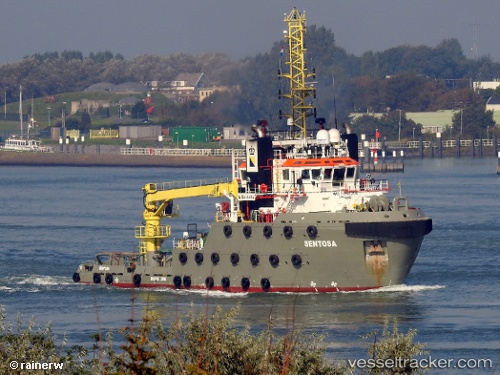
Vessel SEA SENTOSA IMO: 9662356, MMSI: 244790370 Reserved
UTC, 35.88128, 14.51705, course: 223, speed: 0
UTC, 35.88128, 14.51704, course: 223, speed: 0
2026-03-13 04:13:56 UTC, 35.88126, 14.51702, course: 223, speed: 0
Live Vessel SEA SENTOSA Analytics (details, animations, etc.)
Live AIS position: UTC. Near Birgu (Vittoriosa)), updated 2026-03-13 04:13:56 UTC.Find the position of the vessel SEA SENTOSA on the map. The latter are known coordinates and path.
marine traffic ship tracker show on live map
The current position of vessel SEA SENTOSA is 35.88126 lat / 14.51702 lng. Updated: 2026-03-13 04:13:56 UTCCurrently sailing under the flag of Netherlands
Details:
Last coordinates of the vessel:
UTC, 35.88129, 14.51701, course: 223, speed: 0UTC, 35.88128, 14.51705, course: 223, speed: 0
UTC, 35.88128, 14.51704, course: 223, speed: 0
2026-03-13 04:13:56 UTC, 35.88126, 14.51702, course: 223, speed: 0