 vesseltracker.com
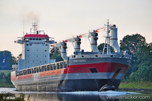
Vessel Trinityborg IMO: 9546485, MMSI: 244810209 Multi Purpose Carrier
UTC, 46.04767, -73.13896, course: 64, speed: 0
UTC, 46.04833, -73.13833, course: -1, speed: 0
2026-02-09 05:53:00 UTC, 46.04767, -73.13897, course: 64, speed: 0
Live AIS position:
UTC. Near Saint-Joseph-de-Sorel),
updated 2026-02-09 05:53:00 UTC.
Find the position of the vessel Trinityborg on the map. The latter are known coordinates and path.
marine traffic ship tracker show on live map
The current position of vessel Trinityborg is 46.04767 lat / -73.13897 lng. Updated: 2026-02-09 05:53:00 UTCCurrently sailing under the flag of Netherlands
Trinityborg built in 2013 year
Deadweight:
21277 tDetails:
Last coordinates of the vessel:
UTC, 46.04833, -73.13833, course: -1, speed: 0UTC, 46.04767, -73.13896, course: 64, speed: 0
UTC, 46.04833, -73.13833, course: -1, speed: 0
2026-02-09 05:53:00 UTC, 46.04767, -73.13897, course: 64, speed: 0