 vesseltracker.com
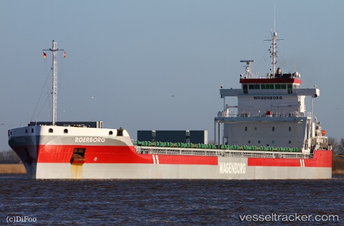
Vessel Roerborg IMO: 9592599, MMSI: 244820055 General Cargo Ship
UTC, 36.81594, 3.09781, course: 272, speed: 0.1
UTC, 36.81573, 3.09740, course: 279, speed: 0.1
2026-02-05 05:24:53 UTC, 36.81589, 3.09755, course: 264, speed: 0.3
Live AIS position:
UTC. Near Algiers),
updated 2026-02-05 05:24:53 UTC.
Find the position of the vessel Roerborg on the map. The latter are known coordinates and path.
marine traffic ship tracker show on live map
The current position of vessel Roerborg is 36.81589 lat / 3.09755 lng. Updated: 2026-02-05 05:24:53 UTCCurrently sailing under the flag of Netherlands
Roerborg built in 2014 year
Deadweight:
23000 tDetails:
Last coordinates of the vessel:
UTC, 36.81582, 3.09763, course: 277, speed: 0.2UTC, 36.81594, 3.09781, course: 272, speed: 0.1
UTC, 36.81573, 3.09740, course: 279, speed: 0.1
2026-02-05 05:24:53 UTC, 36.81589, 3.09755, course: 264, speed: 0.3