 vesseltracker.com
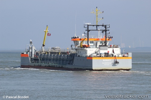
Vessel MAHURY IMO: 9762027, MMSI: 244850565 Hopper Dredger
UTC, 5.81398, -55.16100, course: 34, speed: 8.8
UTC, 5.96697, -55.20633, course: 327, speed: 6.4
2026-03-08 07:20:32 UTC, 6.04283, -55.21546, course: 169, speed: 8.2
Live Vessel MAHURY Analytics (details, animations, etc.)
Live AIS position: UTC. 12 nm NW of Nieuw Amsterdam), updated 2026-03-08 07:20:32 UTC.Find the position of the vessel MAHURY on the map. The latter are known coordinates and path.
marine traffic ship tracker show on live map
The current position of vessel MAHURY is 6.04283 lat / -55.21546 lng. Updated: 2026-03-08 07:20:32 UTCCurrently sailing under the flag of Netherlands
MAHURY built in 2016 year
Deadweight:
1623 tDetails:
Last coordinates of the vessel:
UTC, 5.74969, -55.12482, course: 137, speed: 1.3UTC, 5.81398, -55.16100, course: 34, speed: 8.8
UTC, 5.96697, -55.20633, course: 327, speed: 6.4
2026-03-08 07:20:32 UTC, 6.04283, -55.21546, course: 169, speed: 8.2