 vesseltracker.com
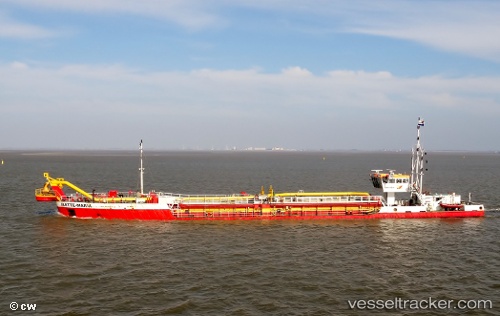
Vessel Mette maria IMO: 9254068, MMSI: 244870700 Hopper Dredger
UTC, 53.89346, 9.15119, course: 219, speed: 0
UTC, 53.89349, 9.15106, course: 219, speed: 0
2026-01-18 21:17:57 UTC, 53.89348, 9.15110, course: 219, speed: 0
Live AIS position:
UTC. Near Kiel Canal),
updated 2026-01-18 21:17:57 UTC.
Find the position of the vessel Mette maria on the map. The latter are known coordinates and path.
marine traffic ship tracker show on live map
The current position of vessel Mette maria is 53.89348 lat / 9.15110 lng. Updated: 2026-01-18 21:17:57 UTCCurrently sailing under the flag of Netherlands
Details:
Last coordinates of the vessel:
UTC, 53.89344, 9.15107, course: 219, speed: 0UTC, 53.89346, 9.15119, course: 219, speed: 0
UTC, 53.89349, 9.15106, course: 219, speed: 0
2026-01-18 21:17:57 UTC, 53.89348, 9.15110, course: 219, speed: 0