 vesseltracker.com
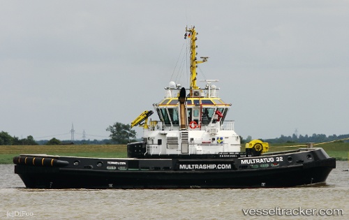
Vessel Multratug 32 IMO: 9796042, MMSI: 244900122 Tug
UTC, 51.45314, 3.71076, course: 241, speed: 0.1
UTC, 51.43322, 3.68020, course: 137, speed: 7.6
2026-02-28 15:57:44 UTC, 51.41341, 3.72163, course: 315, speed: 9.3
Live AIS position:
UTC. Near Borssele),
updated 2026-02-28 15:57:44 UTC.
Find the position of the vessel Multratug 32 on the map. The latter are known coordinates and path.
marine traffic ship tracker show on live map
The current position of vessel Multratug 32 is 51.41341 lat / 3.72163 lng. Updated: 2026-02-28 15:57:44 UTCCurrently sailing under the flag of Netherlands
Details:
Last coordinates of the vessel:
UTC, 51.45315, 3.71077, course: 240, speed: 0.4UTC, 51.45314, 3.71076, course: 241, speed: 0.1
UTC, 51.43322, 3.68020, course: 137, speed: 7.6
2026-02-28 15:57:44 UTC, 51.41341, 3.72163, course: 315, speed: 9.3