 vesseltracker.com
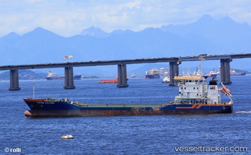
Vessel Pieter Caland IMO: 9516662, MMSI: 244992000 Service Ship
UTC, 51.68836, 4.59368, course: -1, speed: 0
UTC, 51.68837, 4.59368, course: -1, speed: 0
2026-03-01 11:49:07 UTC, 51.68835, 4.59366, course: -1, speed: 0
Live AIS position:
UTC. Near MOERDIJK),
updated 2026-03-01 11:49:07 UTC.
Find the position of the vessel Pieter Caland on the map. The latter are known coordinates and path.
marine traffic ship tracker show on live map
The current position of vessel Pieter Caland is 51.68835 lat / 4.59366 lng. Updated: 2026-03-01 11:49:07 UTCDetails:
Last coordinates of the vessel:
UTC, 51.68834, 4.59357, course: -1, speed: 0UTC, 51.68836, 4.59368, course: -1, speed: 0
UTC, 51.68837, 4.59368, course: -1, speed: 0
2026-03-01 11:49:07 UTC, 51.68835, 4.59366, course: -1, speed: 0