 vesseltracker.com
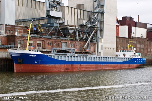
Vessel Panda IMO: 9201968, MMSI: 245014000 General Cargo Ship
UTC, 51.83439, 2.70984, course: -1, speed: 8.8
UTC, 52.12141, 3.11695, course: 39, speed: 8.3
2026-02-28 07:17:27 UTC, 52.25381, 3.31504, course: -1, speed: 8.8
Live AIS position:
UTC. 21 nm SE of Craven Arms),
updated 2026-02-28 07:17:27 UTC.
Find the position of the vessel Panda on the map. The latter are known coordinates and path.
marine traffic ship tracker show on live map
The current position of vessel Panda is 52.25381 lat / 3.31504 lng. Updated: 2026-02-28 07:17:27 UTCCurrently sailing under the flag of Netherlands
Panda built in 2001 year
Deadweight:
2953 tDetails:
Last coordinates of the vessel:
UTC, 51.70036, 2.53303, course: 42, speed: 9.2UTC, 51.83439, 2.70984, course: -1, speed: 8.8
UTC, 52.12141, 3.11695, course: 39, speed: 8.3
2026-02-28 07:17:27 UTC, 52.25381, 3.31504, course: -1, speed: 8.8